|
|

|

|
Geography Dept.The WEST SIDE DRIVING PARK was located in Chicago, Cook County, Illinois. GPS coordinates are: 41° 52' 39.75" N 87° 43' 31.73" W.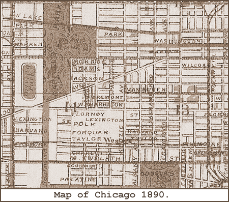
This 1890 map of Chicago shows the WEST SIDE DRIVING PARK was located along 40th Avenue, now known as Pulaski Road, between Madison on the North and West Harrison on the South.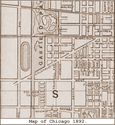
This detail from an 1892 map of Chicago shows the WEST SIDE DRIVING PARK.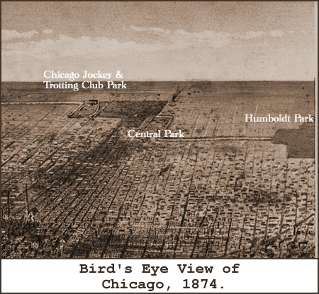
This fascinating map from 1874 of Chicago shows that the WEST SIDE DRIVING PARK got its start as the CHICAGO JOCKEY and TROTTING CLUB PARK. Notice that the track is oriented in an East-West direction, and it appears that the course is East of the Boulevard that connects Central Park to the Douglas Park Boulevard. All later maps of the WEST SIDE DRIVING PARK show it in a North-South orientation and West of the connecting Boulevard. This is definitely the correct location as Central Park was renamed Garfield Park in 1881. But, it is unclear at this time if, or when, the original race track was moved and re-oriented. Or is this map by Currier & Ives just incorrect? For more information on this conundrum see the "History Dept." on the CHICAGO DRIVING PARK page.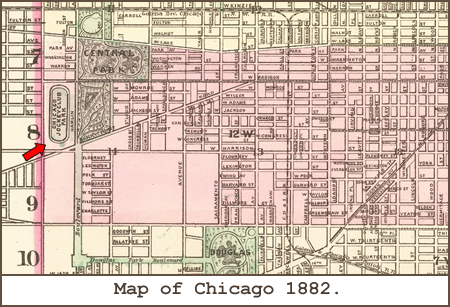
This map, only 8 years later, clearly shows the "CHICAGO JOCKEY CLUB PARK" oval in a North-South orientation. This confirms the Currier & Ives map was slightly incorrect. However, the renaming of Central Park to Garfield Park is not being shown here.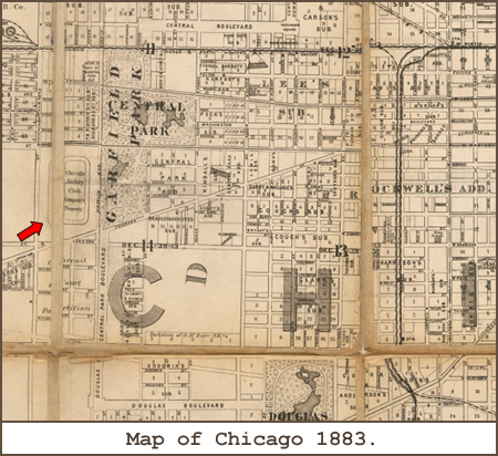
Finally on this map from 1883 we see the name of Garfield Park overlaying the name of Central Park along with the "Chicago Jockey Club Park" immediately to the south and west. Notice the vacant land just to the west of the racing venue. It will shortly become the "Chicago Driving Park and Fair Grounds".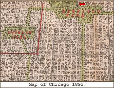
And a final confirmation of the orientation and location of the West Side Trotting Park is seen in this Columbian Expo map detail from 1893. The view is looking West from Lake Michigan.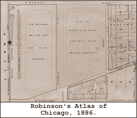
This map section from Robinson's Atlas of Chicago clearly indicates that there were two tracks, as we suspected, at the same Garfield Park location. Obviously the more eastern track, known as the CENTRAL PARK DRIVING ASSOCIATION, came into existence first based on the 1874 map by Currier & Ives. We feel somewhat confident that any reference to the CHICAGO DRIVING PARK after 1874 refers to the western most course on this map, and not the CHICAGO DRIVING PARK that operated at South Michigan Avenue and East 34th Street. Talk about some wicked turns!Picture Gallery.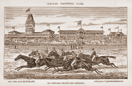
A print, probably from Harper's Weekly, of the park in the late 1880's before it became known as the WEST SIDE DRIVING PARK. Thoroughbreds often raced here even though it was deemed a Driving or Trotting Park.Racing Results.
|
History Dept.The WEST SIDE DRIVING PARK probably has the most controversial history of any racing venue in Illinois; a history steeped in corruption, politics, and mystery. It opened in 1878 as the CHICAGO JOCKEY and TROTTING CLUB PARK. There is some recorded history of the going's on at the park prior to 1888 either as the CHICAGO DRIVING PARK or the CHICAGO TROTTING PARK. This all changed when gambling kingpin Mike McDonald took over in 1888. In 1891 McDonald convinced the manager of the WEST SIDE DRIVING PARK, Ed Corrigan, to move his racing to nearby Stickney, establishing Hawthorne Race Track. McDonald and some politically connected cronies took over the property and reopened the race track in 1892 as the GARFIELD PARK RACE TRACK. 1892 was a very tumultous year at the track; a raid or two by the Chicago police, a near riot, and three shootings. A shoot out on September 6th of the same year resulted in the deaths of two Chicago policemen and a trigger-happy former Texas sheriff named James Madison Brown.A Brief Timeline of Events.
|


|
|