|
|
|

|
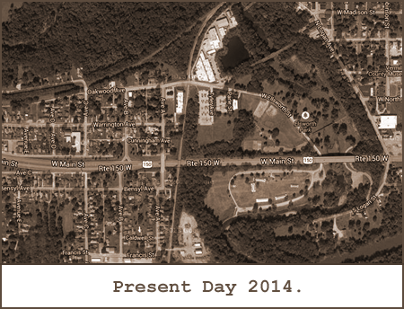
Geography Dept.The DANVILLE RACETRACK was located just west of the North Fork of the Big Vermillion River in Danville, Illinois. GPS coordinates are: 40° 07' 26.8" N, 87° 38' 27.5" W.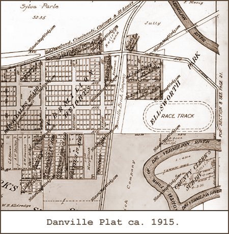
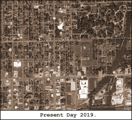
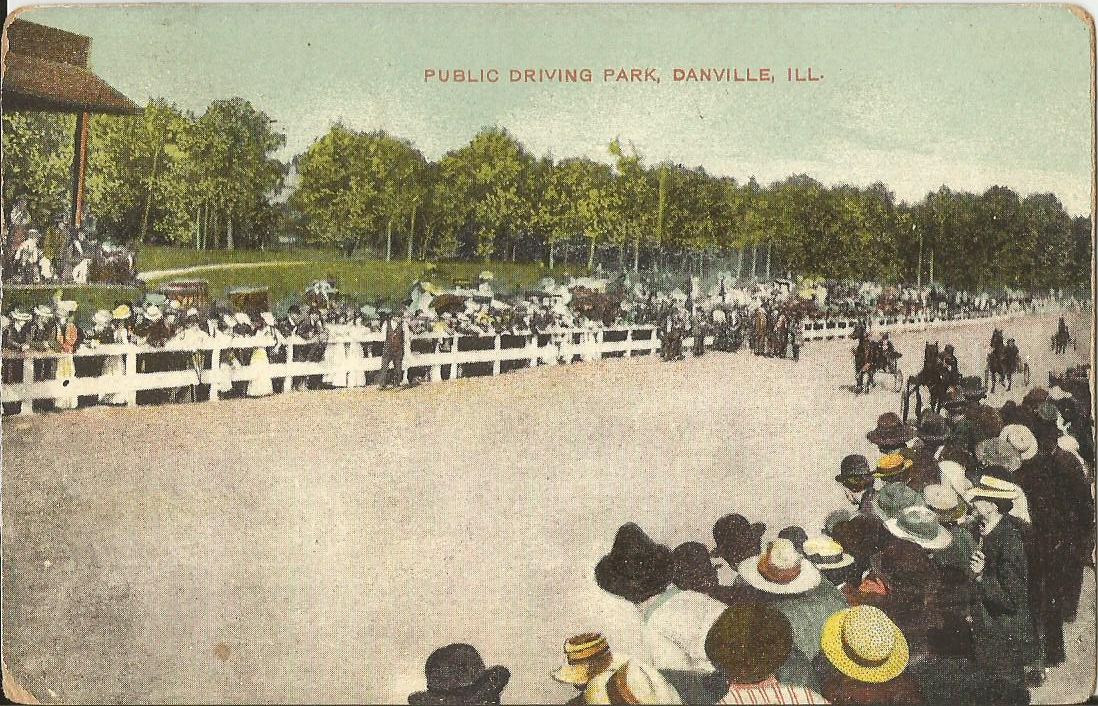
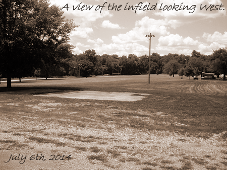
The DANVILLE RACETRACK was nestled between Traction Avenue (now Ellsworth Avenue) and the North Fork of the Big Vermillion River in Ellsworth Park.The original trotting venue in town was the DANVILLE FAIR GROUNDS located at the corner of, what was then and still is, West English Street and North Vermilion Street. GPS coordinates are: 40° 08' 32.5" N, 87° 37' 50.6" W.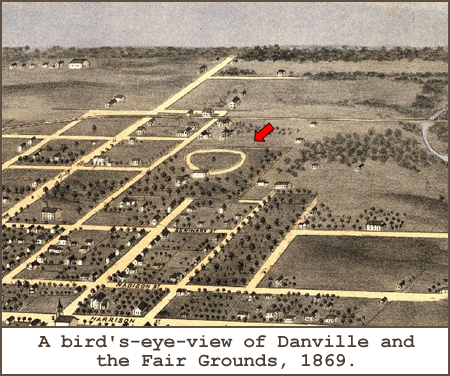
The Fair Grounds racing oval is clearly visible several blocks north of Harrison Street in this unique bird's-eye-view close up of Danville.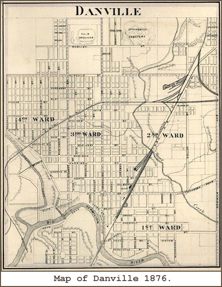
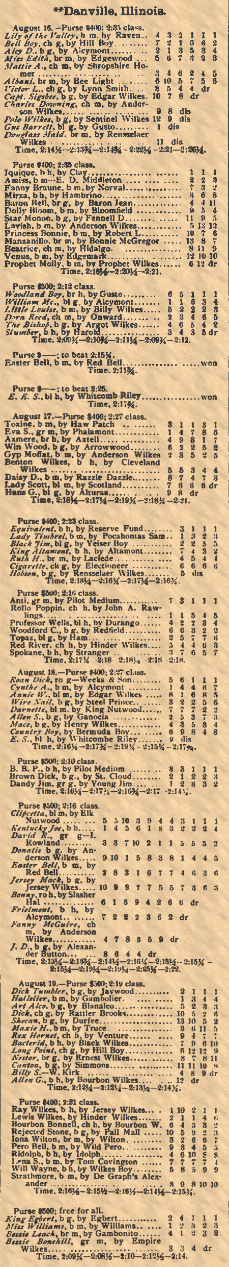
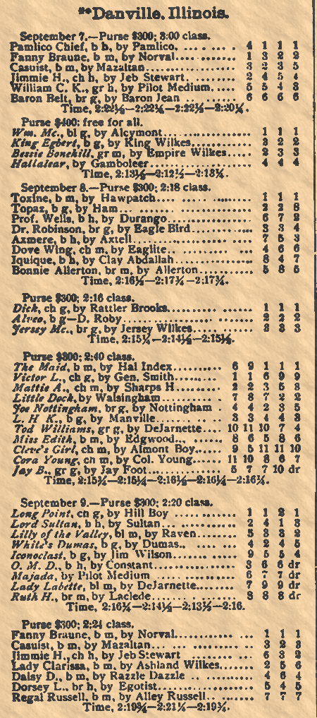
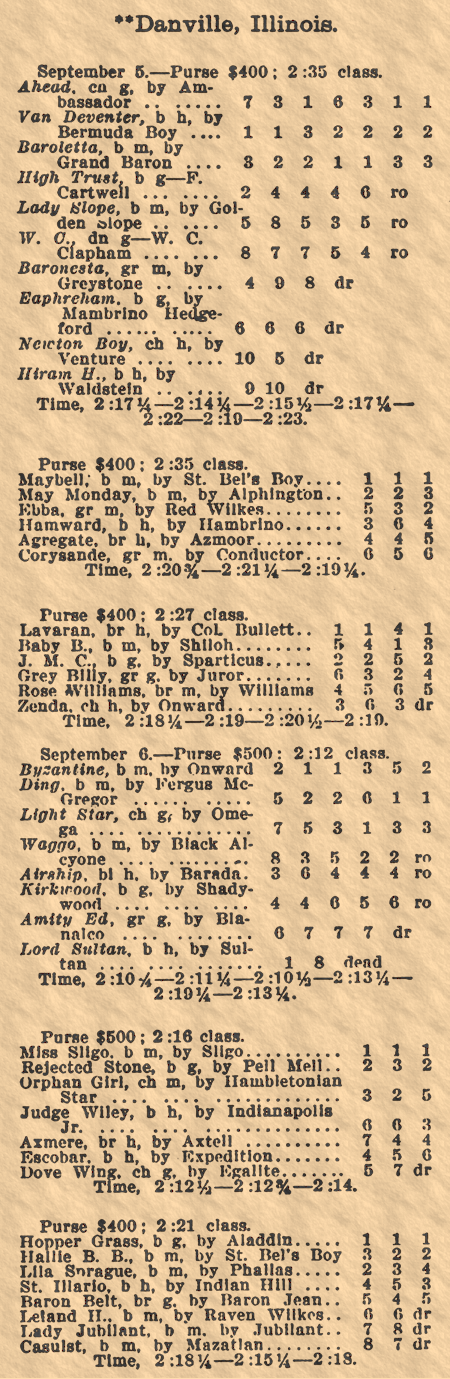
You can see the Fair Grounds oval at the very top and left of center in this map from 1876.Racing Results.
|
History Dept.
Ellsworth Park was the place to be for recreation in the early 1900s. In the 1910s, it featured a horse racing track. In the 1920s it had a 9-hole golf course, and later a very popular public swimming beach.
|